New high precision instruments for surveying and geodesy
Challenge
The determination of distances with low measurement uncertainty, linked to the SI, is used in the surveillance of large-scale facilities during construction and the deformation monitoring of critical infrastructures. It is also important in observations of geological hazards, such as volcanoes or tectonic faults and can help chart sea level rise caused by climate change. These applications are increasingly requiring measurements with an uncertainty less than 1 mm over distances up to 5 km.
Electronic Distance Meters (EDM) measure length by determining the time a laser beam takes to travel between two points. Instrument readings can be distorted by the air’s refractive index along the beam path, however. This has restricted range as to reach the targeted accuracy would require knowledge of the temperature along the whole beam better than 0.2 oC over 5 km - nearly impossible to achieve in practice using classical meteorological sensors.
Global Navigation Satellite Systems (GNSS) provide accurate surface positional information. Their use for absolute distance measurements between points has been limited by a lack of knowledge on the source of measurement errors and uncertainties associated with signal delays caused by the troposphere, ionosphere and other effects.
A new range of high precision geodetic instruments and methodologies were required to provide the accuracy for emerging measurement needs with consistent link to the SI unit of length.
Solution
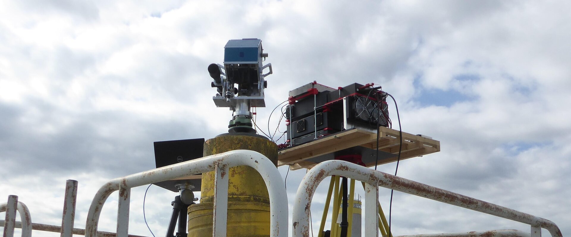
During the GeoMetre project the Conservatoire national des arts et métiers (CNAM) developed a long-range EDM prototype, the Arpent Absolute Distance Meter (Arpent ADM). Two light beams at different wavelengths, 780 nm and 1560 nm, are propagated to a target and returned via a retroreflector. By measuring the dispersion between these the Arpent ADM automatically compensates for temperature and pressure along the beam’s path with sub-millimetre accuracy (0.3 mm) for up to 5 km.
The Universitat Politècnica de València (UPV) extended a GNSS-based distance meter (GBDM) from relatively horizontal 1 km baselines to up to 5 km, including possibly significant height differences (GBDM+). This approach calculates all significant sources of errors including atmospheric and multipath effects, antenna calibration and instrument setups, which are propagated through the whole set of equations to provide the final distance determination.
The two approaches were verified in a two-week campaign at the well-controlled geodetic network of the European Organization for Nuclear Research (CERN) by CERN, UPV, CNAM and the Institut national de l’information géographique et forestière (IGN). This included the thorough determination of uncertainties for both methodologies and, except for one baseline, showed an agreement below the 1 mm level.
Impact
The compact and field-deployable Arpent ADM provides sub-millimetre measurements in minutes compared to the hours it takes to integrate satellite signals, but a line of sight is required between the instrument and its retroreflector (i.e. baseline ends). Furthermore, the measurement uncertainty is more straightforward to assess.
The GBDM+ methodology constitutes a significant step forward in the application of GNSS to open air length metrology and compliments Arpent ADM as it does not require a line of sight. By providing knowledge on all relevant measurement error sources it allows these to be mitigated, providing absolute distance determination down to 1 mm with known measurement uncertainty.
Both were used to verify a new 5 km baseline established in the project, the EURO5000, and the National Institute of Aerospace Technology (INTA) and Centro Español de Metrología (CEM) are now using these tools to establish the INTA1000 calibration baseline in Spain.
The GeoMetre consortium continues to collaborate with CERN’s Geodetic Metrology Group, part of the Beam Department (BE-GM), to explore the potential use of the Arpent ADM and GBDM+ systems in establishing the surface network for the Future Circular Collider (FCC). With a circumference of over 90 km, the FCC would be the largest particle collider ever constructed.
The new instruments and methodology developed represent beyond state-of-the-art geodetic metrology and are expected to make a significant impact in geological and climate surveillance in the years to come.
- Category
- EMPIR,
- SI Broader Scope / Integrated European Metrology,
